

![[backarrow]](b_arrow.gif) :tilbake til hovedsida..........jump to the English main page:
:tilbake til hovedsida..........jump to the English main page:
![[english-arrow]](c_arrow.gif)

Rogaland county
Below you'll find
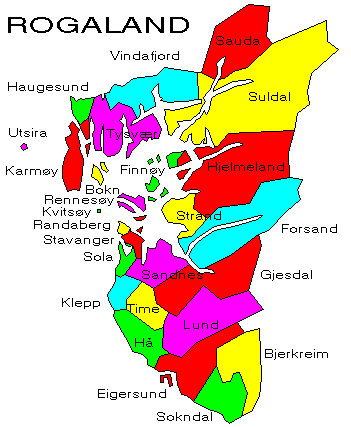
- a map showing the county and all of its municipalities,
- a table showing the population and size of each municipality.
As a basis for this map is used a .bmp-file in a program called HYPERNOR v. 1.0., distributed by Programvareklubben MCS, Pb. 3541, 7002 Trondheim, Norway. Some corrections and the adaptation to HTML has been done by Johan I. Borgos. (Please include this statement if you copy this page and use it on a website or on printed matters.)
The municipalities
Source: Statistisk sentralbyrå
| Municipality | Pop. 1990 | Pop. 2000 | Km2/miles2 |
|---|---|---|---|
| 1101 Eigersund | 12 391 | 13 288 | 430/166 |
| 1102 Sandnes | 44 340 | 52 998 | 303/117 |
| 1103 Stavanger | 97 570 | 108 818 | 70/27 |
| 1106 Haugesund | 27 600 | 30 362 | 72/28 |
| 1111 Sokndal | 3 487 | 3 358 | 294/114 |
| 1112 Lund | 3 101 | 3 096 | 414/160 |
| 1114 Bjerkreim | 2 340 | 2 456 | 660/255 |
| 1119 Hå | 13 034 | 13 921 | 255/98 |
| 1120 Klepp | 11 788 | 13 789 | 115/44 |
| 1121 Time | 11 929 | 13 317 | 182/70 |
| 1122 Gjesdal | 7 263 | 8 911 | 609/235 |
| 1124 Sola | 15 719 | 18 915 | 69/27 |
| 1127 Randaberg | 7 561 | 8 773 | 25/10 |
| 1129 Forsand | 999 | 1 018 | 773/298 |
| 1130 Strand | 9 545 | 10 122 | 215/83 |
| 1133 Hjelmeland | 2 827 | 2 756 | 1 092/422 |
| 1134 Suldal | 4 119 | 4 043 | 1 728/667 |
| 1135 Sauda | 5 355 | 5 081 | 513/198 |
| 1141 Finnøy | 2 777 | 2 865 | 106/41 |
| 1142 Rennesøy | 2 561 | 3 111 | 65/25 |
| 1144 Kvitsøy | 492 | 523 | 6/2 |
| 1145 Bokn | 738 | 786 | 48/19 |
| 1146 Tysvær | 8 013 | 8 828 | 419/162 |
| 1149 Karmøy | 35 094 | 36 971 | 228/88 |
| 1151 Utsira | 225 | 256 | 6/2 |
| 1154 Vindafjord | 4 885 | 4 848 | 444/171 |
Up to the map!