

![[backarrow]](b_arrow.gif) :tilbake til hovedsida..........jump to the English main page:
:tilbake til hovedsida..........jump to the English main page:
![[english-arrow]](c_arrow.gif)

Finnmark county
Below you'll find
- a map showing the county and all of its municipalities,
- a table showing the population and size of each municipality.
As a basis for this map is used a .bmp-file in a program called HYPERNOR v. 1.0., distributed by Programvareklubben MCS, Pb. 3541, 7002 Trondheim, Norway. Some corrections and the adaptation to HTML has been done by Johan I. Borgos. (Please include this statement if you copy this page and use it on a website or on printed matters.)
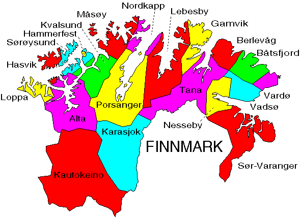
The municipalities
Source: Statistisk sentralbyrå
| Municipality | Pop. 1990 | Pop. 2000 | Km2/miles2 |
|---|---|---|---|
| 2002 Vardø | 3 008 | 2 705 | 601/232 |
| 2003 Vadsø | 5 967 | 6 130 | 1 259/486 |
| 2004 Hammerfest | 9 240 | 9 213 | 848/327 |
| 2011 Guovdageaidnu - Kautokeino | 2 953 | 3 068 | 9 704/3 747 |
| 2012 Alta | 14 857 | 16 837 | 3 845/1 485 |
| 2014 Loppa | 1 687 | 1 426 | 691/267 |
| 2015 Hasvik | 1 337 | 1 200 | 559/216 |
| 2017 Kvalsund | 1 394 | 1 106 | 1 844/712 |
| 2018 Måsøy | 1 839 | 1 477 | 1 136/439 |
| 2019 Nordkapp | 3 975 | 3 517 | 924/357 |
| 2020 Porsanger | 4 475 | 4 451 | 4 873/1 181 |
| 2021 Kárásjohka - Karasjok | 2 652 | 2 901 | 5 464/2 110 |
| 2022 Lebesby | 1 754 | 1 463 | 3 459/1 336 |
| 2023 Gamvik | 1 424 | 1 288 | 1 414/546 |
| 2024 Berlevåg | 1 367 | 1 236 | 1 120/432 |
| 2025 Deatnu - Tana | 3 195 | 3 074 | 4 055/1 566 |
| 2027 Unjárga - Nesseby | 1 037 | 965 | 1 442/557 |
| 2028 Båtsfjord | 2 346 | 2 470 | 1 434/554 |
| 2030 Sør-Varanger | 9 641 | 9 532 | 3 967/1 532 |
Up to the map!