

![[backarrow]](b_arrow.gif) :tilbake til hovedsida..........jump to the English main page:
:tilbake til hovedsida..........jump to the English main page:
![[english-arrow]](c_arrow.gif)

Text and photos: Johan I. Borgos

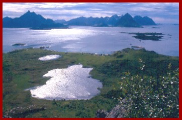
| What and where | View from Skogsøya in Øksnes |
|---|---|
Norway consists of 19 "fylker" (counties). Some of them are divided into regions. Vesterålen is the northernmost region in Nordland county. The region is made up of five "kommuner" (municipalities): Andøy, Bø, Hadsel, Sortland and Øksnes. Vesterålen is a group of islands (see map) between 68o 30' and 69o 20' North. Other places at the same latitude (Greenland, Alaska, Siberia) have an arctic climate. But the steady and mighty Gulf current glides along our coast, so Vesterålen and the rest of Norway enjoy much warmer summers and winters than their latitude neighbours. |
 |
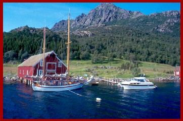
| Summer Sunday at Solum in Sortland | What people do |
|---|---|
 |
The population in Vesterålen is now between 30,000 and 31,000, but was larger in earlier times, when a combination of fishing and farming was the main basis for the economy. More than 90 percent of the population depended on this combination for their living. Fishing still plays an important role in the economy, but not as big as a hundred years ago. And the number of farms has been reduced by more than eighty percent the last fifty years. |
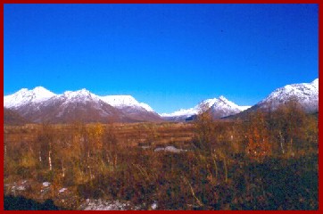
| The nature | Autumn at Forfjorden in Andøy |
|---|---|
The islands in Vesterålen are mountaineous. The highest top reaches 1266 meter (4154 feet) above sea level, but most of the peaks are well below 1000 meter (3280 feet). There are wide areas of lowland, too. Forty percent of the land lies lower than sixty meter (200 feet). Another landscape feature are a lot of small fiords and inlets on every islands. The fishing fleet used many of them as harbours, and most of the population still lives at such places - Andenes, Myre, Sigerfjord, Stokmarknes, Melbu and many more. The largest place today, Sortland, is also situated near the sea, where the strip of sea between Langøya and Hinnøya is at its narrowest. |
 |
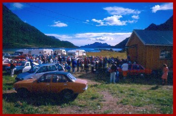
| An evening gathering at Raftøra in Hadsel | People and culture |
|---|---|
 |
In times with hunger or scarcity in Southern Norway a lot of people moved north, where the fisheries usually provided enough food and income. Vesterålen got many of these "immigrants", so most of the people in the region descend from someone coming north in earlier times. In addition they may have a combined Norwegian and Saami heritage. Before the 1950s the "fiskerbonde" culture dominated the cultural picture. A "fiskerbonde" was a couple, a fisherman and his farmer wife. This at least thousand years way of living laid the foundation for the local culture in a wide meaning - a system of knowledge, values, behaviour and ideals. |
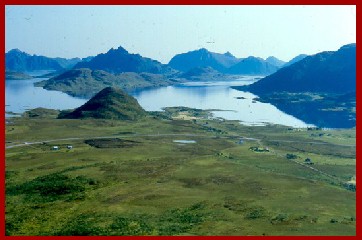
| Wide, wild, varied and friendly | View from Ramnåsen in Bø |
|---|---|
As you can see from the map the region is wide in all directions. The photos show wild mountains, a very rugged coastline and lowland areas. That's nature. You have to visit Vesterålen to discover a very important side of the culture: The friendly and generous attitude of its inhabitants. If you need help, you'll get it. Helping each other is a vital part of our survival kit! Tourism is a fast growing trade in the Vesterålen region. You can take a look at the Vesterålen Reiseliv website to find out more about various attractions and activities. But to really learn about Vesterålen you'll have to make more than a short visit here. You'll have to stay for a while. |
 |